Hurricane Polo made landfall on Mexico's Baja California Sur peninsula on September 28, 2026, as a Category 3 storm with top sustained winds of about 115 mph (185 kph). The U.S. National Hurricane Center tracked the storm as it approached from the Pacific, prompting widespread warnings and preparations. Mexico's Navy and Defense Ministry deployed roughly 7,000 personnel and opened 169 temporary shelters for the region. The storm was forecast to cross the Gulf of California and make a second landfall in southern Sonora late that night or early September 29.
The National Hurricane Center placed Polo 175 km (110 miles) southwest of Cabo San Lázaro at 05:00 MST (12:00 UTC) on September 28, with maximum sustained winds of 185 km/h (115 mph) and an estimated minimum central pressure of 958 hPa. Hurricane Warnings covered sections of both coasts of the Baja California Sur peninsula and mainland Sonora. Hurricane-force winds extended up to 65 km (40 miles) from the center, while tropical-storm-force winds reached up to 165 km (105 miles).
Rainfall forecasts warned of 150 to 305 mm (6 to 12 inches) across parts of Baja California Sur, with southern and central Sonora expected to receive 100 to 150 mm (4 to 6 inches) and maximum totals near 200 mm (8 inches). The heavy rain could produce life-threatening flooding and mudslides, especially in steep terrain. Baja California Sur suspended school activities through September 29 in all five municipalities and halted routine state, municipal and federal government work on September 28 and 29. Maritime activities were suspended, and the State Civil Protection Council established a command post in Comondú.
Officials identified Comondú, Loreto and Mulegé as the principal areas of concern. The state listed 169 potential temporary shelters with total capacity for 33,192 people. In Puerto San Carlos, a fishing town of about 5,700 people, residents boarded up homes and workers hauled dirt and rubble to shore up embankments. Some families planned to head to shelters in Ciudad Constitucion, about 37 miles (60 kilometers) away, while dozens of people elsewhere in the state were evacuated.
Key Facts
At 12:00 UTC on September 28, Polo was moving north-northeast at 17 km/h (10 mph). The storm was forecast to make landfall in Baja California Sur late that afternoon or early evening before reaching southern Sonora as a hurricane late that night or early September 29. The Watchers reported on September 28 that Hurricane Warnings covered the west coast of Baja California Sur from Punta Abreojos to Santa Fe, the east coast from Loreto to Bahía San Juan Bautista, and mainland Mexico from Bahía Kino to Huatabampito.
Reuters reported on September 27 that Hurricane Polo had weakened to a Category 3 storm and was expected to make landfall on the Pacific coast of Baja California Sur on Monday night. As of Sunday evening, the hurricane was about 200 miles (320 km) off the Baja California coast, moving north-northwest at 12 mph (19 km/h) with sustained winds of 125 mph (200 km/h), according to the National Hurricane Center. Private forecaster AccuWeather said Polo is expected to gradually weaken before making landfall as a Category 1 hurricane, but could still topple trees and power lines and inflict structural damage.
Reuters also reported on September 27 that two minors died and their parents remain missing after their home was swept downstream in the state of Jalisco on Mexico's Pacific coast, according to the state Civil Protection and Fire Department. In the resort city of San Jose del Cabo, authorities restricted access to beaches as the storm churned up large waves and dangerous surf. Polo was forecast to dump 4 to 8 inches (10 to 20 cm) of rain across Baja California, with maximum amounts of 12 inches (30 cm) across Baja California Sur, raising the risk of life-threatening flooding and mudslides, before crossing the Gulf of California and moving into the northern states of Sonora and Chihuahua.
The Associated Press reported on September 28 that residents of Baja California Sur boarded up homes and workers hauled dirt and rubble to shore up embankments as Hurricane Polo bore down on the peninsula. In Puerto San Carlos, a fishing town of about 5,700 people, some feared high tides and pounding waves from Polo could breach barriers and send seawater into the community. Rocio Sanchez, a fisherwoman, said, "Civil Protection told those of us here in San Carlos to evacuate because this is a high-risk area. With the current tides, the expected waves and the wind, the earthen barriers they built (to prevent flooding) could give way."
The Associated Press also reported on September 28 that Laura Velazquez, national coordinator of Mexico's Civil Protection Agency, reported that Polo would make landfall later in the afternoon. The Mexican navy gathered personnel and humanitarian aid in the ports of Guaymas and Mazatlan and deployed three vessels to resupply coastal communities isolated by the storm. Storm activity in the Pacific has been above average during what is already the peak of hurricane season, according to National Weather Service lead forecaster Bob Oravec.
Analysis
The bigger picture here is that Hurricane Polo represents a rare double landfall threat for Mexico, with the storm poised to strike the Baja California Sur peninsula and then southern Sonora within hours. The National Hurricane Center forecast landfall in Baja California Sur late on September 28 and a second landfall in southern Sonora late that night or early September 29. This one-two punch is unusual because most eastern Pacific hurricanes either curve out to sea or weaken significantly after interacting with the Baja California peninsula. Polo's forecast track across the Gulf of California keeps it over warm water long enough to remain a hurricane, according to the center.
The storm's impacts are already being felt. Reuters reported on September 27 that heavy rain, high surf and strong winds had prompted evacuations, port closures and school cancellations along Mexico's Pacific coast. Two minors died in Jalisco, and their parents remain missing. That tragedy underscores the dangers of flooding and mudslides, which forecasters warned could be life-threatening. The Associated Press reported on September 28 that some families in Puerto San Carlos planned to head to shelters in Ciudad Constitucion, about 37 miles (60 kilometers) away. The state government's decision to suspend school activities through September 29 in all five municipalities and halt routine government work on September 28 and 29 reflects the severity of the threat.
What this really means is that Mexico's emergency response is being tested on multiple fronts. The Navy and Defense Ministry deployed roughly 7,000 personnel and opened 169 temporary shelters with capacity for 33,192 people. The Mexican navy also gathered personnel and humanitarian aid in the ports of Guaymas and Mazatlan and deployed three vessels to resupply coastal communities. Meanwhile, the National Hurricane Center warned that Polo could bring heavy rain and flooding to parts of the U.S. Southwest later in the week. The storm's moisture could reach Arizona, New Mexico and Texas, though the exact path remains uncertain.
The active Pacific season is a factor. The Associated Press reported on September 28 that Hurricane Nolo edged away from Hawaii while Hurricane Polo bore down on Mexico. Nolo had maximum sustained winds of 105 mph (165 kph), and parts of the Big Island could get up to 20 inches (50 centimeters) of rain. More than 120 National Guard members were activated, part of roughly 400 statewide after the governor issued an emergency proclamation. President Donald Trump recently approved an emergency declaration, authorizing FEMA to coordinate assistance. Hawaii residents are still recovering from Hurricane Lala, which swept about 100 homes off their foundations on the Big Island. Also on September 28, Tropical Storm Rachel formed well off Mexico's southwest coast with maximum sustained winds of 40 mph (65 kph) about 300 miles (485 kilometers) south of Acapulco. The simultaneous activity highlights the strain on forecasters and emergency managers.
Why It Matters
Hurricane Polo's landfall in Baja California Sur threatens a region that is home to popular tourist destinations, fishing communities and fragile infrastructure. The storm surge, high winds and heavy rains could cause life-threatening flooding and mudslides, particularly in steep terrain. The 169 shelters with capacity for 33,192 people are a critical resource, but their activation also signals the scale of the potential displacement. In Puerto San Carlos, a town of about 5,700 people, residents feared that high tides and pounding waves could breach earthen barriers and send seawater into the community.
The second landfall in Sonora could bring additional flooding to a region that is less accustomed to hurricane impacts. Southern and central Sonora were forecast to receive 100 to 150 mm (4 to 6 inches) of rain, with maximum totals near 200 mm (8 inches). The storm's remnants could then push into the U.S. Southwest, where heavy rain and flooding are possible later in the week. The National Weather Service lead forecaster Bob Oravec noted that storm activity in the Pacific has been above average during what is already the peak of hurricane season.
The human toll is already evident. Two minors died in Jalisco, and their parents remain missing after their home was swept downstream. That loss of life, combined with the evacuations and shelter activations, illustrates how quickly a hurricane can turn dangerous. The Mexican navy's deployment of three vessels to resupply coastal communities isolated by the storm shows the logistical challenges of reaching affected areas. For a country that faces hurricanes on both coasts, Polo is a reminder of the need for robust early warning systems and coordinated response.
Next Up
Forecasters will continue to track Polo as it crosses the Gulf of California and makes its second landfall in southern Sonora late on September 28 or early September 29. After that, the storm's remnants are expected to move into the northern states of Sonora and Chihuahua, and possibly into the U.S. Southwest later in the week. The National Hurricane Center will issue updates as the storm weakens over land. Meanwhile, Tropical Storm Rachel is being monitored off Mexico's southwest coast, and Hurricane Nolo continues to move away from Hawaii.
For residents of Baja California Sur, the focus will shift to recovery once the storm passes. The state government will assess damage to infrastructure, homes and businesses. The 169 shelters will remain available as needed. The Mexican Navy and Defense Ministry will continue to support relief efforts. The coming days will reveal the full extent of Polo's impact, but the preparations already in place may have saved lives.
Related Articles
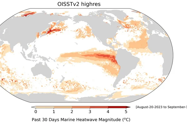
European Seas Reach Hottest Summer on Record as Marine Heatwaves Reshape Fisheries
A Reuters analysis of sea-surface temperatures shows European waters averaged 21.6 C from June to August 2026, the hottest summer since satellite records began in 1982.

UN General Assembly Adopts First Declaration on Sea Level Rise as Guterres Warns 770 Million at Risk
World leaders at the 81st UN General Assembly session endorsed a landmark text on rising oceans that preserves the statehood and maritime rights of island nations even if their land is submerged.

UK pledges £331 million to treat climate change and nature loss as national security threats
The UK committed £331 million to fight climate driven instability, with £330 million for the Global Environment Facility and £1 million for the UN Climate Security Mechanism.
Comments (0)
Log in or sign up to leave a comment.
No comments yet. Be the first to share your thoughts.