Andhra Pradesh woke on November 3, 2026 to a coastline it had barely begun to repair. Severe Cyclonic Storm Murasu crossed the south Andhra coast near Ongole before dawn, with wind speeds of 100 to 110 kmph gusting to 120 kmph, according to the India Meteorological Department. The storm arrived less than a week after Cyclone Arnab killed seven people in the same state, while relief camps and district offices were still working through Arnab's damage lists.
The sequence is what makes this week unusual. Arnab made landfall on Wednesday, October 28, with wind speeds of 150 kmph. Murasu followed in the intervening night of November 2 and 3, and the two landfall areas sit about 268 km apart in a straight line, according to The Federal. Two severe cyclones hitting the same state within six days is not a routine feature of a record that stretches back to 1891.
The state entered the week already carrying a bill. Down To Earth reported on November 2, 2026 that Andhra Pradesh had submitted a preliminary damage assessment of Rs 4,600 crore to the central government for Arnab, which affected at least 18 coastal and adjoining districts. Chief Minister N. Chandrababu Naidu announced compensation of Rs 5 lakh for each bereaved family, along with per hectare assistance for coconut and banana growers. Officials were still counting when the next system formed.
Murasu, a name proposed by India that means war drum in Tamil, intensified from a depression over the southwest and adjoining southeast Bay of Bengal. IMD scientist S. Karuna Sagar said in Amaravati that the system was very likely to continue moving and intensify into a severe cyclonic storm. By November 2 the forecast path had firmed up: a crossing between Nellore and Narsapur with sustained winds of 100 to 110 kmph gusting to 120 kmph.
Key Facts
The India Meteorological Department said in a press release dated November 3, 2026 that Murasu crossed the south Andhra Pradesh coast between Nellore and Narasapur close to Ongole, near 15.53 degrees north and 80.22 degrees east, during 03:30 to 05:30 IST with a wind speed of 100 to 110 kmph gusting to 120 kmph.
The Hindu reported on November 3, 2026 that the storm began landfall at 1 a.m. and that the eye crossed the coast at 5:30 a.m. By 2:30 p.m. the system had weakened into a cyclonic storm with maximum sustained winds of 80 to 90 kmph gusting to 100 kmph, centred about 40 km west northwest of Bapatla. IMD forecast further weakening to a deep depression, with 55 to 65 kmph winds gusting to 75 kmph, by midnight on November 3.
Rainfall was concentrated and extreme. Bapatla recorded the heaviest total in the state, 213.16 mm in the 24 hours to 8:30 a.m. at the Agricultural College gauge. Naguluppalapadu in Prakasam district received 198.01 mm and Ongole Urban 174.7 mm. Of 61 gauges that crossed 100 mm, 57 were in Bapatla, Prakasam and West Godavari districts. Konanki in Bapatla district added 182.25 mm between 8:30 a.m. and 2 p.m. on the same day.
The Andhra Pradesh government said 10,805 people were in relief centres and estimated that the cyclone would damage about 30,661 hectares of paddy, 21,474 hectares of cotton and 605 hectares of maize. The National Disaster Response Force said no loss of life had been recorded in Andhra Pradesh, with 14 teams deployed. NDRF Deputy Inspector General Mohsen Shahedi said about 1.75 lakh people in coastal Andhra were affected and around 10,000 were in 171 relief shelters.
Disruption reached transport links and neighbouring states. The Vijayawada division of South Coast Railway suspended train movements on the Vijayawada to Ongole to Gudur section, and 19 domestic flights were cancelled in Andhra Pradesh. Odisha shifted more than 1.6 lakh people to safety as a precaution.
Analysis
The rarity is the story. The Federal reported on November 2, 2026 that the formation of two severe cyclones in such quick succession requires a near perfect alignment of oceanic and atmospheric conditions, and that records going back to 1891 show only a handful of comparable episodes. The closest precedent cited was October 1999, when a severe cyclonic storm struck southern Odisha on October 17 and 18, roughly 11 days before the Odisha Super Cyclone made landfall near Paradip on October 29, 1999 with sustained winds up to 260 kmph and a storm surge of 5 to 7 metres. That disaster officially claimed 9,887 lives and destroyed more than 1.6 million homes.
The Federal attributed Murasu's rapid formation after Arnab to exceptionally warm sea surface temperatures, high deep ocean heat content, elevated atmospheric moisture and relatively low wind shear. It noted that single events cannot be attributed directly to climate change, but that research increasingly shows warming oceans favour faster intensification and longer lasting severe cyclones. During El Nino years, North Indian Ocean cyclones tend to form closer to the Equator, raising landfall odds along the Andhra Pradesh and Tamil Nadu coasts. The Bay of Bengal produces roughly four times as many cyclones as the Arabian Sea.
What this really means is that the operative risk has shifted from the individual storm to the interval between storms. A state can absorb one severe cyclone in a week if the follow up arrives after the pumps have been serviced, the embankments patched and the compensation payments cleared. Murasu did not allow that interval. Crops that survived Arnab were standing in saturated ground when 213 mm of rain fell on Bapatla, and relief centres opened for Arnab were still occupied when the second evacuation order went out.
The human ledger this time is better than it had any right to be. A severe cyclone with 120 kmph gusts crossing a densely populated delta before dawn produced no recorded casualties in Andhra Pradesh, a result that speaks to the accuracy of the IMD track forecast, the speed of the NDRF deployment and the willingness of coastal residents to move. It would be a mistake, though, to read that as a statement about future storms rather than about this one.
Why It Matters
The money is already a problem. Down To Earth reported on November 2, 2026 that the preliminary Arnab assessment submitted to the central government was Rs 4,600 crore, with seven dead and at least 18 districts affected. The Federal put preliminary Arnab losses at around Rs 4,700 crore across 12 districts, and reported that coastal Andhra was still severely flooded when Murasu approached. Both estimates describe a bill that will be revised upward once Murasu's field damage is added.
Agriculture carries the sharpest exposure because the timing lands in the harvest window. The state estimates 30,661 hectares of paddy, 21,474 hectares of cotton and 605 hectares of maize at risk, on top of Arnab's toll on perennial crops. Naidu's package set assistance at Rs 54,000 per hectare for damage to coconut plantations across 1,293 hectares, plus Rs 1,500 for each coconut tree uprooted or with crown damage, with officials estimating about 195,000 coconut trees damaged. Banana farmers were to receive Rs 35,000 per hectare for losses across 15,000 hectares. A second storm in the same season converts a one year income loss into a multi year one.
The institutional response is the part that worked, and it is worth being precise about why. IMD tracked the system with Doppler Weather Radars at Chennai, Machilipatnam and Visakhapatnam and issued district level colour coded warnings on November 2 with five districts under red, seven orange and six yellow. On November 3, three districts were under red warnings, seven orange and 16 yellow, with orange alerts covering Rayalaseema, Tamil Nadu, Puducherry, Karaikal and Telangana for 115.6 to 204.4 mm of rain. Warnings do not stop water, but they do move people, and the absence of casualties is the measurable return on that work.
Next Up
IMD forecast that Murasu would weaken into a deep depression by midnight on November 3 and into a depression with 40 to 50 kmph winds gusting to 60 kmph near 17.2 degrees north and 80.0 degrees east by 05:30 IST on November 4. Conditions were expected to improve on November 4, and IMD issued no weather warning for West Bengal in association with the system. The state's immediate task is the same one it faced a week ago, only larger: drain the fields, restore the suspended Vijayawada to Ongole to Gudur rail section and finish a damage assessment now covering two storms.
The harder question is whether the state's relief architecture, built for discrete events, can be resized for a season. Back to back landfalls compress every stage of recovery into days, and the precedent from 1999 is a reminder that a second system can be far stronger than the first. The forecasts show Murasu fading over the Deccan, but the conditions that produced it, warm water and moist air over the Bay of Bengal, have not changed.
Related Articles

Bolivia declares national emergency as super El Nino threatens drought and floods
President Rodrigo Paz signed Supreme Decree 5759 on 31 October 2026, activating exceptional budget and procurement rules for nine months as drought damages crops and livestock.
Montreal Protocol parties open Kigali meeting with a billion-dollar cooling bill to settle
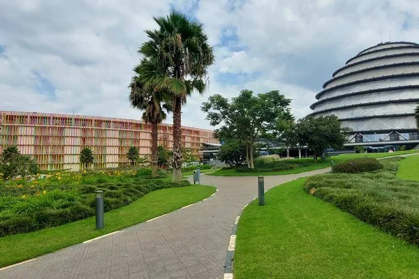
Delegates in Rwanda mark ten years of the Kigali Amendment while haggling over how much wealthy countries will pay to keep a refrigerant phase-down on schedule.

Meta signs 200,000 ton low carbon cement certificate deal to anchor Fortera plant in Missouri
Fortera says the multiyear commitment gives it the revenue visibility required to finance a $150 million plant in Ste. Genevieve, Missouri, which is designed to produce 300,000 tons of low carbon cement annually.
Comments (0)
Log in or sign up to leave a comment.
No comments yet. Be the first to share your thoughts.