The UK Met Office said on August 21, 2026 that the El Niño event developing over the Pacific Ocean is set to be the strongest in living memory, with sea-surface temperatures in the tropical eastern Pacific likely to exceed 3 °C above normal at its peak around October–November. Adam Scaife, head of long-range forecasting at the Met Office, told the BBC the anomaly level would be "unheard-of in modern climate records." Past El Niño events of comparable severity, in 1997–98 and 2015–16, peaked at roughly 2 °C above normal.
Why This El Niño Is Different
The Met Office attributes the projected intensity to a combination of factors. Very high temperatures in the deeper ocean — roughly 8 °C above normal at a depth of 100 meters in some places — are providing a reservoir of warm water that can be released into the atmosphere as the El Niño matures, essentially supercharging the event. The 2026 El Niño is also happening against a background of human-induced warming of roughly 1.4 °C since the late 19th century, which raises the baseline above which any natural variability operates. World Meteorological Organization Secretary-General Celeste Saulo said there is "no evidence" that climate change increases the frequency of El Niño events, but the impacts of any single event are amplified in a warmer world.
What Is Already Happening
The Met Office forecast lands as Indonesia is already experiencing its worst fire season since 2015. Reuters reported on August 20 that wildfires burned nearly 95,000 hectares across Indonesia in July, almost double the area burned in the previous six months combined. Mark Parrington, a scientist at the Copernicus Atmosphere Monitoring Service, told the New Scientist the fire-emission estimates for July are comparable to the worst previous El Niño years and that ground-based sensors are measuring smoke pollution levels previously detected only in El Niño conditions. The 1997–98 Indonesian fires emitted as much as 2.5 gigatonnes of CO2, equivalent to roughly a third of annual global fossil-fuel emissions at the time. Australian fire authorities have warned that almost every state and territory is facing heightened bushfire risk.
The 2027 Heat Record and Food-Security Implications
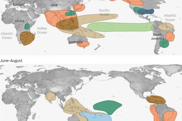
Met Office climate scientist Nick Dunstone said the heat released from the ocean into the atmosphere is particularly pronounced in the calendar year following the winter peak of an El Niño, making 2027 "very likely to replace 2024 as the warmest year on record." The Met Office's modelling suggests that global-average temperatures could exceed 1.5 °C above pre-industrial levels for the full calendar year of 2027, a sustained breach that would mark a new phase in the climate trajectory. The implications for food security are direct: El Niño suppresses the southwest monsoon in South Asia — already running well below normal in 2026 — and increases drought risk in northern South America and the West Pacific.
What to Watch Through Year-End
Three checkpoints follow. The Met Office's next global-long-range forecast, scheduled for mid-September, will give the first quantitative read on whether the central-Pacific anomaly is on track to exceed 3 °C or stabilize below it. The COP31 UN climate summit in November will be the first multilateral test of whether the 2026 El Niño intensifies pressure for higher nationally determined contributions under the Paris Agreement. And the EU's Copernicus Climate Change Service will publish its October wildfire-emission bulletin, which will be the first formal estimate of how 2026 Indonesian fire-emissions compare with the 1997–98 reference event.
Related Articles
September 2026 was Earth's second warmest on record as oceans set all time heat mark
NOAA NCEI reports September 2026 ranked as the second warmest September globally while global ocean surface temperatures hit an all time monthly record, driven by a record strength El Nino.

Hurricane Isaias Becomes Latest First Atlantic Hurricane Since 1905 and Reaches Category 3
The National Hurricane Center says Isaias packed 120 mph winds and 959 mb as it closed on the western Florida Panhandle, forcing evacuations and shutting in 63 percent of Gulf oil output.

Italy and Czech Republic Seek Temporary Suspension of EU Carbon Market
A joint letter from Rome and Prague asks Brussels to pause the EU Emissions Trading System and delay ETS2, arguing that high energy and carbon costs threaten European manufacturing.
Comments (0)
Log in or sign up to leave a comment.
No comments yet. Be the first to share your thoughts.